

MAGE history in detail
1972. In 1972, Complex Marine Arctic Geological-Geophysical Expedition (CMAGE) was established in Murmansk as part of Northern marine scientific production geological-geophysical association (PGO “Sevmorgeo”) of the USSR Ministry of Geology.
In 1981, it was renamed to Marine Arctic Geological Expedition (MAGE).
1978. The geotraverse reference program in the Atlantic Ocean began.
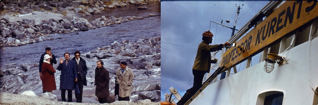
1987-1990. Participation in Soviet Antarctic expeditions: geological and geophysical research on the shelf of the Ross and Weddell Seas.
1990. The first seismic line in the East Siberian Sea was worked out.
1994. Incorporation of the company.
2002. A 2D seismic survey was conducted in the Mediterranean Sea offshore Libya, in the Norwegian sector of the North and Barents Seas. Comprehensive studies on the Spitsbergen shelf were resumed.
2005. A team of MAGE authors was awarded the RF Government Prize in Science and Technology for the development, scientific substantiation and implementation of advanced technologies to create an ecological and geological basis for the subsoil use of the West Arctic shelf of Russia.
2009. The Moscow branch of JSC MAGE was opened.
2012. A seasonal shallow seismic group was created in St. Petersburg. An onshore group started to conduct 2D land seismic survey.
2013. For the first time, a full range of engineering and geological surveys was carried out at the construction site of an exploration and appraisal well in the Pechora Sea.
For the first time in MAGE history 3D seismic headed by JSC MAGE in the Sea of Okhotsk was performed.
The first kilometers of onshore seismic survey in Yamal were completed.
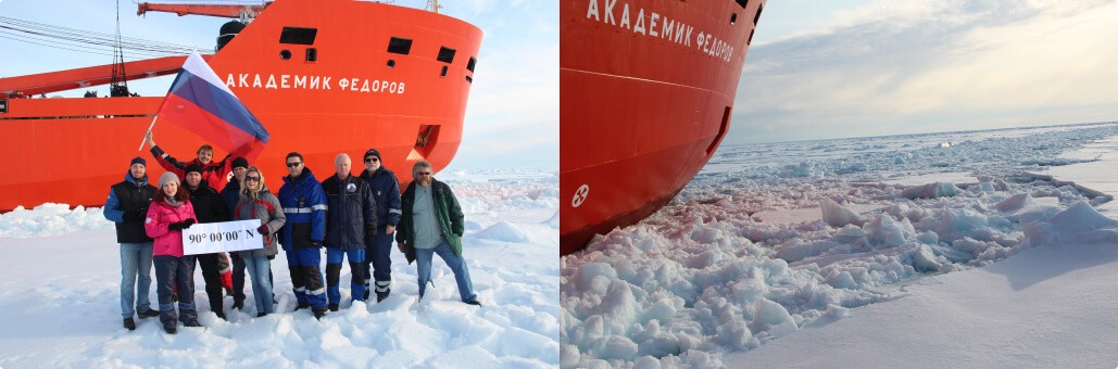
2014. There were carried out geophysical surveys in the polar regions of the Russian Arctic. Seismic, gravity and bathymetry data in the amount of 10,000 km became the basis for substantiating the extended boundaries of the continental shelf of the Russian Federation. For the first time a seismic line passed through the North Pole.
A new direction of the company’s activity was mastered – the use of a remotely controlled unmanned underwater vehicle (ROV) for surveying targets and territory at the stage of engineering surveys, examining suspended and abandoned wells.
2016. A new direction of activity was mastered – the integrated offshore vessel service for oil and gas projects. A representative office was opened in the city of Sochi to develop projects in the Black and Caspian Seas.
There were performed integrated geophysical works in the area of the continental slope of the East Siberian Sea.
2020-2021. Start of the full-cycle production of the “CRAB” bottom seismic stations and the “PIKET” acoustic positioning system.
2020. Opening of a monument to the veterans of the Great Patriotic War in Murmansk, near the company's office.
2021. The company conducted its first 4D seismic survey in the Sea of Okhotsk.
2022. For the development and implementation of the innovative digital marine seismic system "CRAB" with bottom recorders, the team led by A.G. Kazanin was awarded the Prize of the Government of the Russian Federation in the field of science and technology.
2023. Seismic monitoring of oil and gas fields. 4D/4C operations in the Sea of Okhotsk.
- New services for large-scale, high-precision gravity and magnetometric surveys;
- New focus area: "Airborne Geophysical Research";
- Development of domestic software for processing and imaging seismic data "Altair-M Seismika 2D/3D".